 NERC Data Catalogue Service
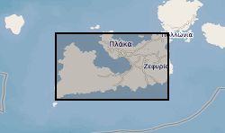
Hydrothermal alteration
Type of resources
Topics
Keywords
Contact for the resource
Provided by
Years
Formats
Representation types
Update frequencies
-

Summary of semi-quantitative whole-rock XRD analysis of hydrothermal alteration across the island of Milos, Greece. The samples were acquired during numerous field visits between 2010 and 2018 by the British Geological Survey and GW4+ Doctorial Training Partnership (NE/L002434/1). The data were acquired using a PANAlytical X’Pert Pro diffractometer at the British Geological Survey, Keyworth, UK. These data were primarily used to identify mineral phases to improve our understanding of regional and local paleo-hydrothermal activity. This may be useful within the metallic and industrial mineral mining sector and associated researchers. The data includes grid references (± 5 m), field observations and instrument running conditions. Samples from 2010 are supported by a grant award from the Natural Environment Research Council (GA/09F/139). Samples from 2016 - 2018 are supported by the GW4+ Doctoral Training Partnership (NE/L002434/1) grant award GA/09F/139 – RMS E3557, and the British Geological Survey’s University Funding Initiative (BUFI S345).
-
This dataset provides an overview of hydrothermal alteration samples from the island of Milos, Greece, that were analysed using a portable infrared mineral analyser (PIMA) or AgriSpec spectrometer. During data acquisition, spectrums were input into The Spectral Geologist (TSG) to provide an instant and estimated mineral identification using the shortwave infrared (SWIR) part of the electromagnetic spectrum. The samples were acquired during field visits between 2017 - 2019 by the British Geological Survey and the GW4+ Doctorial Training Partnership (NE/L002434/1). This data was primarily used to aid sample collection for further hydrothermal alteration analyses to improve our understanding of regional and local paleo-hydrothermal activity across the island. Identification by the TSG provides an estimation only, and the raw data files in .txt, .fos and .csv formats, are supplied for each analysis in the attached zipped file. This may be useful within the metallic and industrial mineral mining sector and associated researchers. The data includes grid references (± 5 m), TSG interpretations, and field/sample observations noted during data acquisition. GW4+ Doctoral Training Partnership (NE/L002434/1) is supported by grant award GA/09F/139 – RMS E3557, and the British Geological Survey’s University Funding Initiative (BUFI S345).